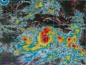
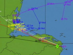
MET Office traces TD Matthew and Flood Prone Areas
 In our last newscast on Friday, the seventeenth tropical depression for this year intensified and became Tropical Storm Matthew. It initially posed a threat to our nation over the past weekend. Around the country, hurricane preparedness went in full swing since the preliminary forecast for the depression showed that it could culminate as a hurricane that could whip through our country on Saturday or Sunday morning. Fortunately, that did not materialize. There was a lot of fanfare over the airwaves but Matthew was the storm that wasn’t. However, there are some flood waters coming our way. News Five spoke to Chief Meteorologist Dennis Gonguez this afternoon about Matthew’s passing.
Dennis Gonguez, Chief Meteorological Officer
“It made landfall just near the Honduras/Nicaragua border as a tropical storm. Part of its circulation remained over the warm waters in the Gulf of Honduras. It maintained its intensity even after it crossed Honduran mainland. However, the distance between Honduras and Belize was a bit too short for it to intensify any further. Although we saw a tropical storm coming off the Honduran mainland.”
Jose Sanchez
“So, all in all, all we got were rains?”
Dennis Gonguez
“We got about nine inches over the entire event. We got about nine inches down south in Punta Gorda Town. A bit over eight inches at Savannah Forest Station and about seven point nine inches in the Mountain Pine Ridge at Barton Creek. So most of the rainfall as expected was concentrated in the south.”
Jose Sanchez
“Essentially, nothing happened from the central part of the country to the north, however we did see flooding. What was the main cause of the flooding?”
“Again the rainfall. And some flooding in Belize City was exacerbated by the high tide—we had a high tide just around midday on Saturday—so that also exacerbated the flooding in Belize City. However, the extent of flooding is a bit reduced now. We don’t expect it to be widespread although the head waters from the Mopan River have not reached our border as yet. So there is a possibility that we could see some water levels rising on the Mopan River and eventually the Belize River. The same goes for the Rio Hondo. The Rio Hondo is above normal and is rising slowly and possibly we could see some waters coming over from across the border causing the Rio Hondo to go up a bit more.”
Jose Sanchez
“And so how soon should we see something?”
Dennis Gonguez
“In the next couple of days. I would say around Wednesday, we could see some rise in the Belize River around that time.”
Jose Sanchez
“It’s a cause for concern, but is it a cause for alarm?”
Dennis Gonguez
“No. it’s not a cause for alarm. We should be concerned that the rivers levels may be rising. They are already above normal and they could be rising later in the week, but it is not a cause for alarm for such an event unfolding.”


God has spared us again….eventhough we have so much violence.
we should all be grateful….n thank God